JEO 2 - The Curious Orbits of the QZSS
A monthly news roundup and a deep-dive on Japan's QZSS navigation satellite constellation.

Welcome to Japan Earth Observer (JEO), a free monthly newsletter with a news roundup and one in-depth article about the space, Earth observation and geospatial industries in Japan. In addition to a news roundup, in this edition I’m also going to do a deep dive on Japan’s QZSS navigation satellite constellation.
News & Announcements
💱 Contracts and Funding
- ArkEdge Space won a contract from JAXA to develop a lunar navigation system [Inside GNSS]. We’re all familiar with GPS and other Earth navigation systems, like Galileo and Beidou (see below for a discussion of Japan’s unique QZSS system), but with more missions going to the moon, we’re going to need a similar system for our favorite moon. Enter LunaNet, a Lunar Navigation Satellite System (LNSS) aimed at supporting lunar exploration and development. JAXA will be providing ArkEdge with ¥5 billion (~US$32.5 million) in a four year contract to develop the key technology components.
- Space robotics firm, GITAI, raised another US $15.5 million in venture funding [SpaceNews], for a total of $83 million, to continue building its in-orbit servicing capabilities. Japanese billionaire (and astronaut), Maezawa Yusaku, led the funding round. GITAI was founded in Japan, but moved its headquarters to the United States in late 2023 in order to pursue United States space and defense markets. The firm is engaged in development of robotic arms, lunar rovers, lunar construction robots, and other products and services. They have a 1.5m S2 robotic arm on the ISS, and their next launch will be a 500kg spacecraft launch with SpaceX in October 2025.
- Synspective, one of two Japanese companies building and operating synthetic aperture radar (SAR) satellite constellations, went public on the Tokyo Stock Exchange [Payload] on 19 December. The public offering raised more than US $60 million, and in mid-January, they had a market cap of about ¥57 billion (~US$370 million). CEO Arai Motoyuki and Shirasaka Seiko founded the firm in 2018 as a spinout of a Japanese government research program.
- Interstellar landed a new ¥7 billion (~US$44 million) investment from Woven by Toyota [SpaceNews] as part of the first tranche of a Series F round. “Woven by Toyota” may sound like an adventurous new textile venture for cars, but it’s actually a Toyota innovation unit started in 2021 and aimed at developing new autonomous logistics and transportation solutions for land, sea, and air. This new funding is doubling-down on an earlier investment of US$21 million for Interstellar’s Series E in August 2024, and an additional round is expected as soon as June 2025. Interstellar is racing SpaceX, Amazon, and others to create a vertically integrated satellite manufacturing, launch, and communications business (similar to SpaceX’s Starlink). In addition to funding, Toyota has been helping with manufacturing, mass production, and supply chain expertise, and Woven by Toyota CEO, Kumabe Hajime will be joining the Interstellar board.
- PASCO has been awarded a JAXA contract to distribute Daichi-4 (ALOS-4) radar imagery [SatNews]. The ALOS series of Earth observation satellites includes both SAR sensors and multi-spectral optical sensors. Both ALOS-2 and ALOS-4 collect SAR data, specifically, phased array L-band synthetic aperture radar (PALSAR). ALOS-4 was constructed by Mitsubishi Electric, launched in July 2024 on an H3 rocket, and is designed to provide 3 meter resolution data with a 200km observation swath. PASCO is the lead on the contract, but they’ll also be working with RESTEC and Tellus to promote use of the ALOS-4 data.
- Astroscale has been selected to develop on-orbit refueling technologies [Space & Defense]. The ¥12 billion (~US$77 million) 5-year contract is being awarded under the K Program. Officially known as the "Key and Advanced Technology R&D through Cross Community Collaboration Program”, the K Program is operated by the Cabinet Office and Japan Science and Technology Agency (JST) and it’s aimed at supporting initiatives that have the potential for impact on Japan’s global competitiveness.
- Synspective has been selected by METI to develop a synthetic aperture radar (SAR) data solution for monitoring ground displacement in mining facilities [Synspective] in Latin America and Africa. The work will rely on Synspective’s InSAR*2 analysis technology, and its team will include Yokogawa Electric, Insight Terra, and SRK Consulting.
- iQPS signed a contract to use four Rocket Lab Electron rockets to launch its SAR satellites in 2025 and 2026. IQPS is building toward a 36-satellite SAR constellation.
- Planet Labs PBC inked a US$230 million deal with SkyPerfect JSAT to build and operate a high resolution Pelican constellation [SpaceNews]. JSAT has been around for more than 35 years, and for most of that time, it has been providing satellite communications and TV services for the Asia Pacific market and it currently operates seventeen such satellites. But it has been expanding into Earth observation, including a major investment in iQPS (see above). JSAT will create a U.S. subsidiary, JSAT Beyond Innovation, to own the new constellation, thereby enabling access to the U.S. defense and intelligence market while continuing to sell to the Japan Ministry of Defense (JMoD). Planet will build out the ten-satellite constellation over the next seven years. This is a big deal for Planet and has been a fillip to their stock price (PL) since the deal was announced.
🛰️ Technology and Infrastructure
- The Japanese government will invest in expanding H3 launch facilities to increase the launch cadence [Yomiuri Japan Times]. Japan wants to launch at least six H3 rockets per year, but the current facilities at Tanegashima require one and a half to three months to prepare each launch. The Ministry of Education, Culture, Sports, Science and Technology (MEXT) (文部科学省) will invest in upgrading the H-IIA rocket assembly building to support H3’s, expand a fuel storage tank farm, and improve equipment for inspecting parts at the Mitsubishi Heavy Industries H3 factory. This kind of facilities investment will likely need to continue for several years if Japan is to reach the 30 launches per year goal it has set for the early 2030’s.
- The ispace Hakuto-R M2 lunar lander (aka Resilience) is on its way to the moon [SpaceNews]. The launch was a SpaceX Falcon 9 rideshare with a Blue Ghost lunar lander, but Resilience is on a different, lower energy trajectory to the moon. It will attempt a landing in the Mare Frigoris in about four months.
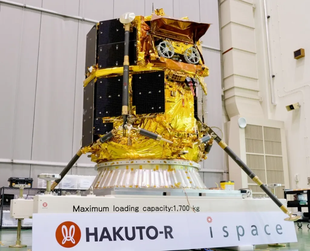
The ispace Hakuto-R M2 lunar lander, during prelaunch preparations. Credit: ispace
- NTT Data will use Arlula GeoStack software to task satellites for the Japanese government [Arlula]. Arlula is an Australian technology startup that creates software for managing EO satellite constellations. NTT Data will provide the GeoStack software to government agencies in order to manage imagery data and more easily task satellites.
- Synspective is expanding its infrastructure both on the ground and in orbit. On December 21, Rocket Lab launched a sixth StriX SAR satellite [SpaceNews], the last in its initial Electron launch services contract. It signed a deal for ten more Electron launches in June 2024, and those will happen 2025 to 2027. To support a higher production volume, it has begun full scale manufacturing operations [Synspective] at its Yamato Technology center. The new center can build twelve satellites per year.
- ispace will work with Magna Petra to mine Helium-3 on the moon [Space.com]. Helium-3 is rare and in short supply on Earth but, due to the lack of atmosphere and magnetic field, it is much more common in lunar regolith. Ispace will transport the Magna Petra mining equipment to the moon and then transport the Helium-3 back to Earth, potentially for use in future fusion reactors
- Another engine explosion will further delay the first Epsilon S launch [Gizmodo]. JAXA oversees two flagship rocket programs. The new liquid fueled, medium-lift H3 rocket is now in regular production by Mitsubishi Heavy Industries after four successful launches since March 2024. The other program is a three-stage, solid fuel rocket, called Epsilon. The latest Epsilon S model is being developed for JAXA by IHI Corporation. This was the second engine test failure and plans for an initial launch test for March 2025 will now be delayed again.
- Space One’s second KAIROS launch [SpaceNews] did better than the first one, but it still didn’t make it to orbit. SpaceOne is trying to be the first commercial company in Japan to successfully launch an orbital rocket. The three-stage, solid fuel KAIROS No. 1 blew up on the launch pad last year. This second attempt in December survived twenty minutes into its flight before being terminated [Kyodo News] because it deviated from its intended flight path. It was carrying five small satellites for the Taiwan Space Agency (TASA), Space Cubics, and Terra Space. Space One was set up by Canon Electronics, Shimizu, and ISI Corporation in 2018 and it operates out of Space Port Kii (スペースポート紀伊) in Kushimoto, Wakayama Prefecture, Japan’s first commercial spaceport. Space One is aiming for a rapid turnaround launch service capable of twenty launches per year.
- L3Harris has completed the Preliminary Design Review (PDR) for the imager that will be on the Himawari-10 weather satellite [SatNews]. L3Harris won a contract in 2023 to adapt its Advanced Baseline Imager (ABI) technology for the next Himawari (ひまわり) weather satellite being built by Mitsubishi Electric. The same L3Harris ABI tech was also used on NOAA’s most recent generation of GOES-R weather satellites. The Himawari-10 is currently planned for a 2028 launch. Himawari means “sunflower” in Japanese.
- Starlab Space has opened a German subsidiary [Payload] in order to provide better access to the EU market. Starlab, a joint venture between Voyager Space, Airbus, Mitsubishi Corporation, and MDA Space, is one of several firms vying to replace the ISS after it is deorbited in 2030. Leveraging its investors, Starlab has also signed research collaborations at the Shonan Health Innovation Park in Fujisawa, Japan and the George Washington Carver Science Park at Ohio State University.
- Pale Blue signed a contract to apply its water propulsion system for D-Orbit [Payload]. Pale Blue is a Japanese startup that has developed a 1U+ water ion thruster. Most rocket and satellite fuel propellants are toxic to humans. Water would be a low cost, safe propellant. D-Space plans to test the technology in launches planned for June and October.
- Following successful demonstration, GITAI is upscaling its product line [SpaceNews]. GITAI flew a 20kg, 16U satellite on the January 12 SpaceX Transporter-12 rideshare launch. The success of the pathfinder mission is a step toward 50kg, 200kg, and 500kg versions of its satellites. There are several companies that promise to manufacture and deliver a satellite. However, all of these firms rely on third party components and have struggled with supply chain issues in the face of high demand. As a result, lead times are often measured in years. GITAI is aiming to build all of the components (except mission-specific sensors and cameras) in-house, including avionics, attitude control, and electrical and chemical propulsion. They expect that this will reduce costs and enable more rapid delivery to customers as they won’t rely on any third parties. The 20kg test satellite had 60% of the components built in-house, and GITAI expects this to be 100% by the end of 2025.
- JAXA and NEC successfully demonstrated optical data relays between satellites [JAXA]. This test was done between the new Daichi-4 (ALOS-4) Earth observation satellite launched to LEO in July 2024 and a data relay satellite in GEO orbit. Contemporary EO satellites collect a shocking amount of data, but if they aren’t within sight of a ground station, they can’t always relay it quickly down to Earth. It may seem counterintuitive to send data further away (40,000 km orbit) before sending the data back to Earth, but by relaying via laser to a satellite in geostationary orbit (one that is presumably sitting over a ground station), the data can reach the surface in a single, high speed microwave transmission, rather than several radio transmissions from LEO broken up across several ground stations. Faster transmission means imagery can be used more quickly. NEC adapted technology it had previously used for terrestrial and marine fiber-optic systems.
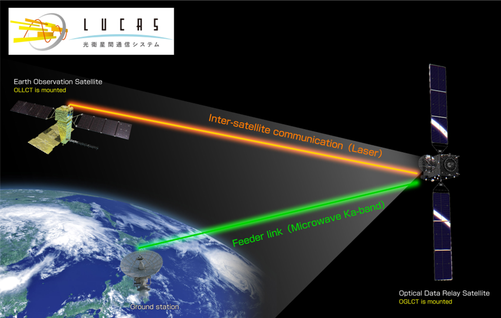
LUCAS optical data transmission system diagram. Credit: NEC
🔭 Science
- Japan Space Systems (JSS) will test space-based solar power supply system with funding from the Ministry of Economy, Trade and Industry (METI). JSS will fly a plane with microwave energy transmitters over Suwa (Nagano prefecture). Thirteen ground receivers will convert the beamed microwaves into electrical power. The next step will be a space-based test of a 150kg satellite that the team expects to launch in FY2025.
- A Japanese astronomer has captured several meteor strikes on the moon [Space.com]. Daichi Fujii, the curator of the Hiratsuka City Museum in Japan, captured the strikes December 6-8, during the annual Geminid meteor showers.
- A joint AI project by Yamagata University and IBM Research has nearly doubled the number of known Nazca geoglyphs. It took almost 100 years to discover the first 430 geoglyphs. The AI-enabled project found 303 more in just six months. [Full paper]

Fifteen of a total of 303 newly discovered relief-type figurative geoglyphs from the AI-assisted survey. Credit: PNAS paper authors: Masato Sakai, Akihisa Sakurai, Siyuan Lu, and Marcus Freitag
- University of Tokyo researchers have developed a data set and model of the long-ignored mesophere layer of atmosphere [Space.com]
- The joint ESA-JAXA BepiColombo mission has successfully completed its sixth Mercury gravity-assist flyby [ESA]. This is the last gravity-assist maneuver until the spacecraft makes its final arrival in Mercury orbit in late 2026.
- Ryugyu samples returned from the Hayabusa 2 mission have helped reveal early solar system magnetic fields [Space.com]. The second of Japan’s Hayabusa asteroid missions returned material from the Ryugu asteroid in 2020, but five years later, the science from that mission is still unfolding.
- A joint Japanese-French science team’s research suggests that the rings of Saturn formed much earlier than previously thought [PBS]. Evidence from the Cassini mission to Saturn had suggested formation of the rings had occurred in the past 300-400 million years. However, this new research, led by Hyodo Ryuki, Chief Scientific Officer (CSO) at SpaceData and including Gustavo Madeira from IPGP and Université Paris Cité, and Genda Hidenori from Science Tokyo (University of Tokyo) indicates that the rings may have formed 4.5 billion years ago, around the same time as the planet formed [IPGP article]
🗺️ International Collaborations
- Japan plans to join the Habitable Worlds Observatory project [Kyodo]. NASA is developing the Habitable Worlds Observatory (HWO) concept for launch in the 2040s. It will be the first space telescope designed specifically to not only find Earth-like exoplanets but also signs of water and atmosphere that could support life. It will be a successor to the currently operating James Webb Space Telescope and the Nancy Grace Roman Space Telescope expected to launch in 2027. NASA currently expects it to be a major international effort with as many as 50 countries making contributions. A specialized team from within JAXA will work on potential contributions; it’s expected to leverage Japanese experience developing instruments for the Subaru Telescope in Hawaii.
- The U.S. Space Force has activated a new unit in Japan [U.S. Forces Japan]. This is the sixth service component created by the U.S. Space Force and is based at Yokota Air Base (横田飛行場) in Tokyo. The Japan Ministry of Defense (JMoD) has established multiple space force units under the SDF, and the new U.S. component is an effort to better integrate U.S. and Japan defense efforts with particular attention to countering China’s rapidly growing space defense capabilities [SpaceNews]. This new unit is called USSPACEFOR-JPN and it will be overseen by HQ USSPACEFOR-INDOPAC [if the U.S. military ever decides to replace bullets with acronyms, they will have a massive arsenal]. The U.S. Space Force’s “hosted payload” on the new QZS-6 satellite represents an early bilateral victory lap [USSF].
Asia-Pacific Conferences & Events
This newsletter is mostly focused on Japan, but I also like to highlight events across the Asia-Pacific region as well.
First, YouTube videos of the FOSS4G Japan 2024 conference sessions held at Senhu University in November 2024 are now available.
Some upcoming conferences include:
- International Space Industry Exhibition (ISIEX), 29 - 31 January 2025 - Tokyo Big Sight - Nikkan Kogyo Shimbun - this event had 20,000 visitors in 2024 -
- Global Space Technology Convention & Exhibition 2025 (GSTC) - 26 - 28 February 2025 Singapore
- FOSS4G Hokkaido, 14 February 2025, Sapporo, Hokkaido, Japan
- State of the Map Japan - 15 February 2025, 1p - 6p, Sapporo, Hokkaido, Japan
- India Space Congress - 27-27 June 2025 - New Delhi, India
- Spacetide - 7 - 10 July 2025 - Toranomon, Tokyo, Japan
- 35th International Symposium on Space Technology and Science (ISTS) & 14th Nano-Satellite Symposium (NSAT) Joint Symposium - 12 - 18 July 2025 - Asti Tokushima, Japan
The QZSS: a GPS for Japan, but better
On February 2 a Mitsubishi Heavy Industries H3 rocket successfully launched the Michibiki 6 navigation satellite [YouTube] for Japan’s QZSS constellation. This the fifth launch of the new H3 rocket was in its H3-22S configuration with two solid fuel strap-on boosters necessary to loft the almost 5,000kg satellite to its initial geosynchronous transfer orbit. From there, it will move itself into a geosynchronous orbit and join the other QZSS satellites.
Some History
The Quasi-Zenith Satellite System (QZSS) (準天頂衛星システム) is a significant departure from other global navigation satellite systems (GNSS). To understand how and why it is different, it may be helpful to delve into a bit of history.
The U.S. GPS system (formerly, Navstar) is the oldest GNSS with the first satellite launched in 1978 and a full constellation of 24 satellites completed in December 1993. Initially designed for military purposes, the GPS was declared a dual use (military and civilian) national asset by President Clinton in 1996 and on 2 May 2000 the so-called “Selective Availability” feature (whereby civilian use of the GPS was deliberately degraded) was turned off and never turned back on. From one day to the next, a radio signal could be processed to determine a fairly accurate location (+/- 5 meters) for anyone possessing a compatible receiver. Applications from surveying to aircraft and vehicle navigation rapidly became available, and with smart phones and applications like Google Maps, instant access to location and navigation tools became part of our daily lives. The United States has launched new GPS satellites to gradually improve the accuracy and utility of the system. However, GPS upgrades have been veeeerrrry slllloooowwww 🐌🐌🐌🐌. GPS III was approved by Congress in 2000 but the first Block III satellite was not launched until 2018, there are still only seven of them, and a full constellation of 24 is still many years away. A modernized ground control segment, called OCX, began development in 2010 but it is billions of dollars over budget and is still not complete, fifteen years later (nice work, Raytheon).
Given the military legacy, the selective availability “feature”, and other reasons, Russia, the European Union, and China moved to develop their own independent navigation constellations to rival the GPS, known as GLONASS, Galileo, and BeiDou (北斗), respectively. The GLONASS and BeiDou constellations developed separately, but after some initial tension, the US and Europe agreed in 2004 to collaborate on the design of the new Galileo radio signals. Galileo and GPS would use different radio frequencies that could coexist without interference while also supporting combined use of both systems by end users, though this would require new receivers to detect the Galileo signal. At the same time, in case of a war, NATO and the United States would be able to use electronic warfare systems to selectively block either or both signals within a given conflict theater.
GPS and Galileo are friends, though GPS has 3 arms, for some reason. Credit: Google Galileo AI
How do navigation satellites work?
All of the GNSS constellations work in fundamentally the same way. Each satellite carries extremely stable atomic clocks that are synchronized with one another as well as similar clocks located in a network of ground stations distributed around the planet. The satellites regularly send signals to the ground stations. Because the speed of radio waves (e.g. speed of light) is a constant, and the ground and satellite clocks are all synchronized and very accurate, the time it takes for the signal to arrive can be measured in order to determine the distance between the two. By calculating this distance from multiple ground stations, the location of the satellite can be computed with a high degree of precision. Each satellite keeps a log of its own position and time, which it broadcasts continuously. If you have a receiver on the Earth, say your smart phone, and your view of the sky includes at least four satellites, your receiver can calculate your position in four dimensions (x, y, z, and time). [It’s actually a bit more complicated than that because those atomic clocks get a tiny bit less accurate as they age, the satellites are whizzing around in medium Earth orbit (MEO) at about 14,000 kph, their roughly circular orbits aren’t perfectly circular, and, well, relativity (h/t to Einstein). So the clocks in orbit drift a bit over time and they have to be corrected by the ground stations.]
Why does Japan need its own satellite navigation system?
Much of the public justifications provided by the government for Japan building its own navigation system have focused on civilian applications like better navigation, road safety, precision agriculture, disaster response, and autonomous vehicles. And, to be sure, Japan does have a lot of mountains and urban canyons (which create location accuracy problems) as well as labor supply shortages that create demand for robotics and autonomous vehicles. And, of course, having better navigation accuracy and precision is undoubtedly a good thing. However, I think we also have to consider two other factors: national security and domestic industrial pressure.
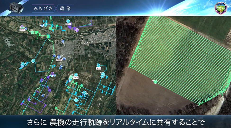
Michibiki enables autonomous farm vehicle operation. Credit: Japan Cabinet Office
On the defense front, Japan faces significant regional threats from North Korea, China, and Russia. These concerns struck home with significant potency when North Korea launched its first Taepo Dong ballistic missile in 1998 on a flight path that went directly over the Japanese islands. The Taepo Dong Shock (テポドン・ショック), as it became known, was a watershed moment in Japan, akin to the effect that the Sputnik launch had in the United States. Further, it coincided with the early stages of a long period of economic stagnation, several high profile and expensive failures in the Japanese space program, and the collapse of the domestic satellite manufacturing industry after the U.S. applied its Section 301 trade law. A wholesale reexamination of both defense and space priorities followed.
Japan had been worried about DPRK missile capabilities for some time. The government allowed the Self-Defense Forces (SDF) (自衛隊) to use space-based observation and communications systems where they already existed, but that pretty much amounted to buying imagery from commercial companies like Digital Globe and Space Imaging (now Maxar), but, critically, the government did not allow the SDF to develop its own defense satellites. Japan was thus completely reliant on what the United States military was willing to pass along. The United States had a very sophisticated signals intelligence and military observation capability with dozens of satellites and ground facilities (including an eavesdropping facility in Misawa, Japan). It turned out that an American reconnaissance satellite had seen the flames from the launch of the Taepo Dong missile but had not relayed that information to the relevant folks in Tokyo.
In the aftermath, the Japanese government made a rapid series of decisions aimed at developing its own capabilities. First, it bought a new Patriot missile array and anti-missile capabilities for its existing Aegis destroyers. Next, in December 1998, Japan began developing a constellation of optical and radar military observation satellites. Developed in secrecy and given the bland moniker, “Information Gathering Satellite” (IGS), they borrowed from the existing civilian ALOS and JERS Earth observation technology and were likewise manufactured by Mitsubishi Electric. In addition to IGS, Japan began developing electronic eavesdropping and communications satellites, known as Kirameki (きらめき), as well as an optical data relay satellite, Kodama (こだま). The fourth defense-related satellite program was a navigation system, the Quasi-Zenith Satellite System (QZSS), also known as Michibiki (みちびき - roughly translating as “guidance”). It’s important to note that these programs are funded and operated out of either the Japanese Ministry of Defense (JMoD) or the Cabinet Office (内閣府), rather than the explicitly civilian JAXA. As such, while civilian applications are emphasized in the public materials (and I am certaintly not suggesting that those civilian uses are insincere), the QZSS is clearly also a backup to the American GPS that is capable of helping military planes, ships, and missiles navigate their way to their intended targets.
Beyond defense objectives, there were also business interests. The Keidanren (Japan Business Federation 日本経済団体連合会) had proposed a satellite navigation system in 1999 and the big manufacturers and systems integrators, like NEC, Toshiba, Itochu, and Mitsubishi Electric made various proposals as well. Given the evisceration of the domestic satellite industry over the previous decade by the application of Section 301 by the U.S, the industrial enthusiasm was understandable; it would enable them to get back in the satellite manufacturing game. Further, if the system had military applications, it would not be subject to Section 301. Japan potentially could have accelerated the deployment of these new military satellites, but it chose to largely develop the technology domestically and thereby cultivate both the skills and the industrial capacity.
It’s GPS… but better
The QZSS navigation satellites were expensive systems to design, develop, and deploy. However, though the technology was developed and built domestically, Japan elected to work closely with the United States in order to make the systems interoperable. Essentially, Japan would create a navigation system that would augment the existing American GPS constellation, improving its accuracy and precision in the Asia-Pacific region, rather than building a separate global system in the way that Europe, China, and Russia had done. At the same time, it could potentially become a backup in case the GPS became unavailable. In close collaboration with the United States, the development team designed the system to transmit signals directly compatible with the GPS L1C/A signal, as well as the modernized GPS L1C, L2C signal and L5 signals. This signal design meant that, unlike Galileo, there would be minimal changes for existing GPS receivers to use the signal. But that was just the start. The QZSS would extend this core GPS signal design in several key ways.
First, the QZSS broadcasts Sub-meter Level Augmentation (SLAS) data on the L1 band. This is similar in concept to the Wide Area Augmentation System (WAAS) operated by the U.S. Federal Aviation Administration (FAA) to augment GPS for commercial aircraft. Next, a Centimeter Level Augmentation (CLAS) service provides a high-precision signal compatible with the Galileo E6 service, on the L6 band. Then there is another augmentation service called Multi-GNSS Advanced Orbit and Clock Augmentation – Precise Point Positioning (MADOCA-PPP) which further augments the CLAS L6 signal. In short, there are a lot of acronyms that add up to a lot of augmentation. Finally, there is also a public messaging service for disaster and crisis management, known as “DC Report” and broadcasting on L1S band in case of floods and earthquakes. Bottom line: the QZSS builds on the GPS concept but it provides higher accuracy and precision as well as additional services to a country that plays host to a lot of natural disasters.
The Curious Orbits of the QZSS
Since Japan’s aim was not to build a new global navigation system, but, rather, to accept the existing GPS as it is and augment it for regional needs, they designed a system that would only need four satellites to be fully operational. To support this the QZSS constellation uses a fairly unusual orbit. Most global systems rely on a minimum of 24 satellites in medium Earth orbit (MEO); that’s the number necessary to have four satellites visible from most locations on the Earth at any given time. MEO is about 24,000km above the Earth’s surface.
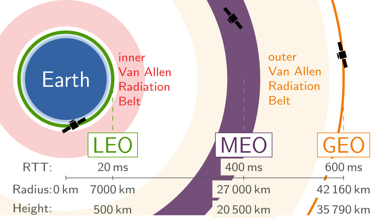
LEO, MEO, & GEO orbits from https://en.wikipedia.org/wiki/List_of_orbits Credit: Sedrubal, CC-BY-4.0
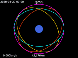
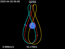
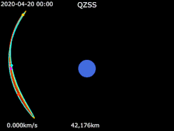
But Japan did not want satellites that spin around the Earth all day; QZSS needed an orbit that kept the satellites over the Asia-Pacific. They settled on a special type of geosynchronous Earth orbit (GEO), known as a Quazi-Zenith or Tundra orbit. QZSS has one satellite in geostationary orbit over Japan and three satellites that are at a similar geosynchronous height (~40,000km) but are highly inclined. Each satellite orbits with a 120° separation from the other two. On the ground their orbit traces a figure-8 pattern over the Asia-Pacific region designed to ensure that one satellite is over Japan at all times. While the orbit was obviously designed for Japan’s needs, it provides the same benefits of improved location for the whole Asia-Oceania region.
Next Generation Michibiki
The new QZS-6 that was just launched is the first of a three-satellite expansion of the current QZSS system. QZS-5 and QZS-7 are expected to be launched over the next year. An additional expansion to eleven satellites is also planned for the future. The expanded constellation structure will support redundancy, additional services, and the potential need to operate independently from GPS.
Apart from growing the QZSS constellation, QZS-6 and QZS-7 will carry an extra payload on behalf of the U.S. Space Force. The extra sensors, which were designed and built by the MIT Lincoln Laboratory, will improve detection and tracking of objects and orbital debris in geosynchronous orbit, a type of mission known as “space domain awareness”. While there are clearly civilian needs to better understand the location and trajectory of objects in GEO orbit, these sensors are also aimed at tracking increasingly sophisticated Chinese defense and reconnaissance satellites capable of dynamically altering their orbits.
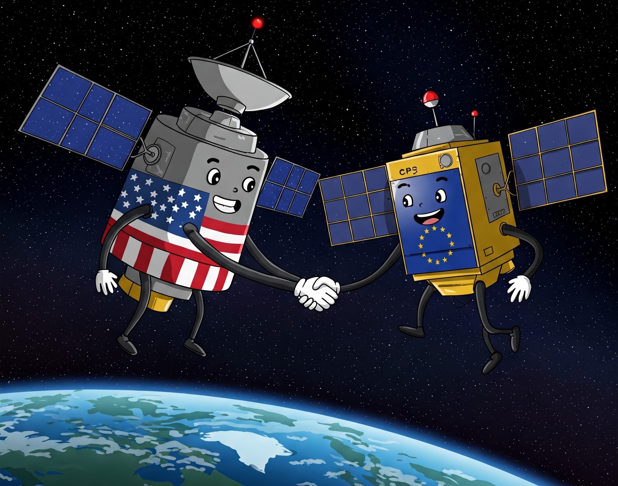
The U.S. and the EU collaborated to ensure that their GPS and Galileo projects were compatible, even if they had different signal designs. But if the U.S. and EU were friends on GNSS constellation development, the use and extension of the GPS signal design and hosting of U.S. sensors on QZSS satellites suggests that the U.S. and Japan are more than just friends in this domain.
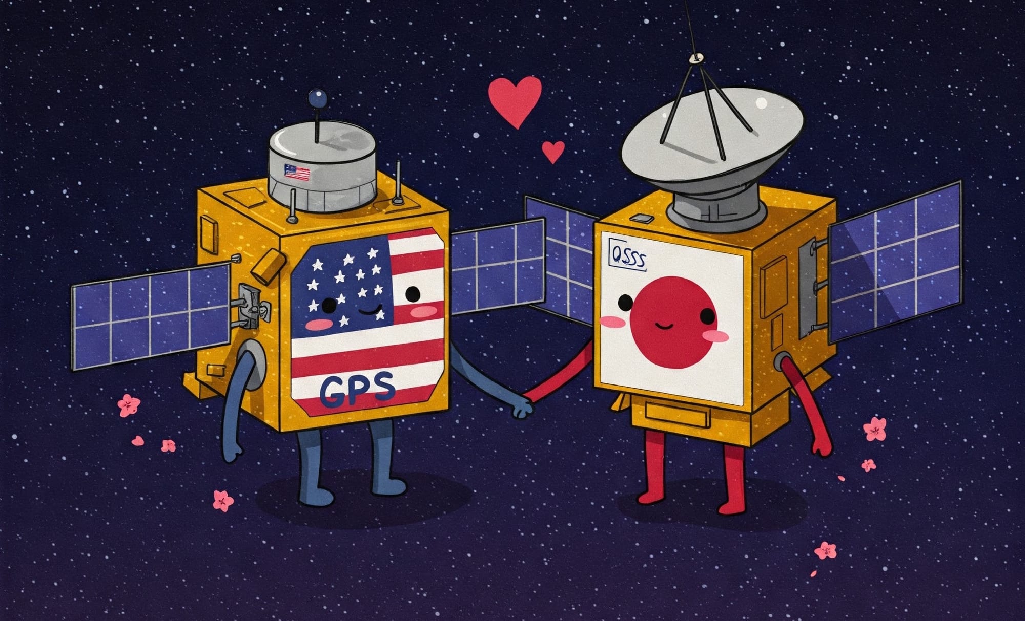
GPS and QZSS are more than just friends. Credit: Google Galileo AI
QZSS gets five star rating from India
Several aspects of Japan’s approach to building a GNSS have been emulated by India. The Indian Regional Navigation Satellite System (IRNSS), also known as NavIC, is an autonomous regional system that leverages similarly inclined geosynchronous (the Tundra orbit that inscribes a figure-8 when viewed from the ground) and geostationary orbits to support navigation and timing services for India plus an area about 1,500km around it. Interestingly, India had an analogous experience to the Taepo Dong incident in Japan. In 1999, India and Pakistan went to war in Kargil. India requested access to the GPS and was denied by the United States. While Selective Availability was turned off the following year, the Indian government determined to build their own system and approved the project in 2006.
Conclusion
Building and operating a navigation satellite constellation is a gigantic technical challenge and a significant expenditure for any nation. Japan has been thoughtful, creative, and pragmatic in its efforts, building on the foundations created by the United States, while significantly extending those ideas with new capabilities that meet its domestic civilian and national security needs. In the meantime, it’s made navigation and positioning services better for everyone operating in the Asia-Pacific and Oceania regions. It deserves an enormous amount of credit.
More soon,
Robert
Also delightful
in the dark of night
Stars in the stream.
– Uejima Onitsura (1661-1738) - translated by William Scott Wilson
闇の夜も
又おもしろや
水の星
Yami no yo mo
mata omoshiro ya
mizu no hoshi